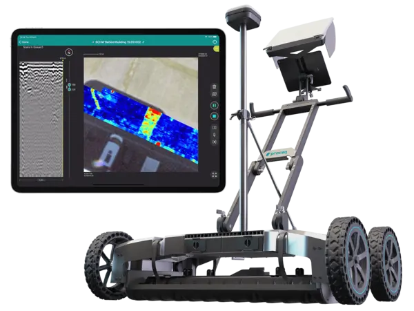
GS9000 Subsurface Mapping GPR Review
The most efficient multichannel GPR system with real-time 3D visualization.
-Interchangeable GPR arrays covering a vast array of applications.
-Get an accurate 3D map of the underground, literally, as you walk.
-Get the most powerful insights from your data, anytime, anywhere.
Real-Time Visualization
The standout feature of the GS9000 is its unmatched efficiency in capturing detailed 3D maps of the underground in real-time.
As you traverse over an area, the system provides immediate feedback, allowing for on-the-spot analysis and decision-making.
This capability is invaluable for professionals in fields where time and accuracy are of the essence, such as in damage prevention and excavation safety.
Versatile Interchangeable GPR Arrays
Flexibility is at the heart of the GS9000 design, featuring interchangeable GPR arrays that can be tailored to suit a wide range of applications.
Whether it's for detailed utility locating and mapping, road and bridge inspection, or even precision agriculture, the GS9000 can be configured to meet the specific needs of any project.
This adaptability not only enhances the system's utility but also maximizes the investment by covering various use cases with a single device.
Powerful Data Insights
The GS9000 doesn't just excel in data collection; it also shines in data analysis.
It offers tools that enable users to derive powerful insights from their data, accessible anytime and anywhere.
This feature ensures that decision-makers can quickly interpret the data, making informed choices without delays, which is critical in dynamic project environments.
Applications Across Industries
The broad applicability of the GS9000 is one of its most compelling attributes. It serves a critical role in damage prevention and excavation safety, helping to avoid costly mistakes and ensure worker safety.
In the realm of subsurface utility engineering (SUE), it provides precise mappings that are essential for planning and development.
Additionally, its utility extends to specialized fields such as archaeology, where non-intrusive subsurface investigations are crucial, and even to forensics and unexploded ordnance (UXO) detection, showcasing its versatility.
Conclusion
The GS9000 subsurface mapping GPR is a technological marvel that significantly advances the capabilities of ground penetrating radar systems.
Its combination of real-time 3D visualization, interchangeable arrays, and powerful data analysis tools makes it a versatile and indispensable tool across a wide range of applications.
Whether for construction, utility management, or scientific research, the GS9000 offers a level of detail and efficiency that can transform the way subsurface mapping is conducted.
With its user-friendly design and robust performance, the GS9000 is poised to become the go-to choice for professionals seeking to leverage the latest in GPR technology for their subsurface mapping needs.
