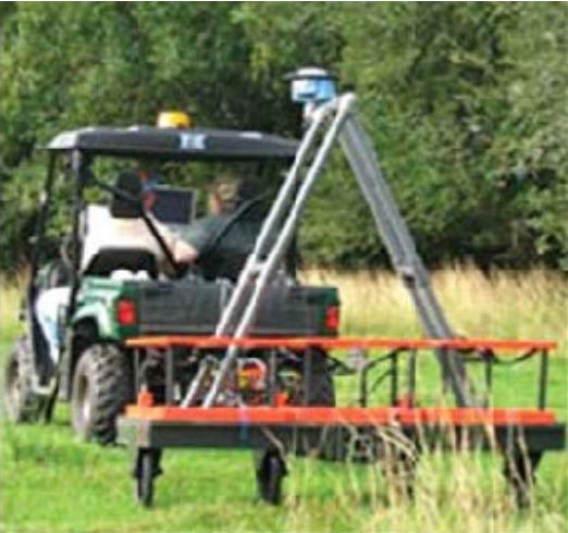
Electromagnetic Terrain Conductivity (EMTC)
Electromagnetic terrain conductivity method measures the average electrical conductivity of a conespaced volume of earth beneath the transmitting and receiving antennas. When a utility is within a cone, the average resistivity is changed to the extent based on the type of utility and its contents, and the local ground conditions.
Most rocks and soils have high electric resistivity. Resistivity of pipe itself can vary from very low (metallic pipe) to very high (large empty clay pipe). Water inside the pipe has low resistivity. The bigger the contrast between the utility resistivity and earth resistivity the more effective this method is in detecting the utility. The method can be effective in locating water and sewer pipes in dry sands or gravel bedding, especially in metallic or empty pipes. The method can detect buried tanks, well shafts and vault covers.
There are two basic antenna configurations for electromagnetic terrain conductivity (EMTC). One is long and linear and the other is square. The long linear antenna measures average conductivity in a coneshaped space from the ground surface to a depth of about 20 feet. Isolated metallic utilities, underground storage tanks, wells, and vault covers are usually detectable by means of this method. Under some conditions, large non-metallic water pipes in dry soils or large nonmetallic empty and dry pipes in wet soils may be imaged.
The square antenna is more efficient than the linear one and alignment of the antenna with the utility is not a factor in detection. Multiple antennas can be combined for a broader swath of coverage, decreasing the time spent collecting data, and increasing the density of the data returned. The square antenna is usually coupled to some sort of survey equipment.

Long Linear Antenna.

Multiple Square Antenna with Integrated Survey.
Applications and Use Cases.
Used to map geological variations, groundwater contaminants or any subsurface feature associated with changes in the ground conductivity such as buried storage tanks. Depth can be upto about 15ft/5m.
Case study that used Terrain Conductivity..
34 Capital Boulevard (NC DOT) in Wake County, NC
28 Lambert Field in St. Louis, MO
19 Alaskan Way Viaduct and Sea Wall Utility Mapping Project in Seattle, WA
